Millions of data points mark key design milestone
Ossian has completed a yearlong metocean data gathering campaign on its site located 84kms off the east coast of Scotland. The data collected relates to wave height, currents, tides, and sediment movements. Sonar systems fixed to the seabed, around 72m below sea level, looking upwards and wave buoys were deployed at three locations across the Ossian site.
As well as underpinning engineering design and environmental impact assessment, the metocean data is also used to predict conditions during the construction and deployment of the windfarm.
Alongside the campaign, a year’s worth of wind climate data was also gathered using Floating Lidar buoys (FLiDAR) which use profiling lasers to measure wind speed and direction.
During the detailed metocean assessment of the 858km2 site, over 20 million data points were recorded by specialist contractors Partrac.

Partrac employees carrying out survey work
Ossian Engineering Manager Laurent Domergue said:
“The completion of the metocean campaign, and the millions of data points it has gathered, is a significant milestone for the Ossian project.
“It has gathered information vital to setting out a design path for the future. The numerical modelling, and results, will also be used during the windfarm certification process, an independent, third-party validation which confirms the project is designed in line with industry standard. Ultimately, this gives investors and other stakeholders confidence that the project has been designed in line with best practice.
“The rate at which Ossian is developing is encouraging and will ensure the project is able to advance as we contribute to the journey to net zero.”
Dr Kevin Black, Technical Director of Marine Surveyors at Partrac, said:
“Gathering this type of data is a big job, in a challenging deepwater environment, and involves a lot of people with a broad range of skills.
“From technicians building and testing measuring instruments in the workshop, to those who visit the survey sites, as well as data analysts, great care is taken to ensure quality robust information is gathered that helps the developer to make vital decisions.
“The data gathered will be vital to helping design the Ossian floating offshore windfarm, including its floating turbines, mooring and anchor systems, as well as substation platforms.
“The FLiDAR equipment will remain deployed until H2 2024 and will help gather further information vital to predicting energy yield.“
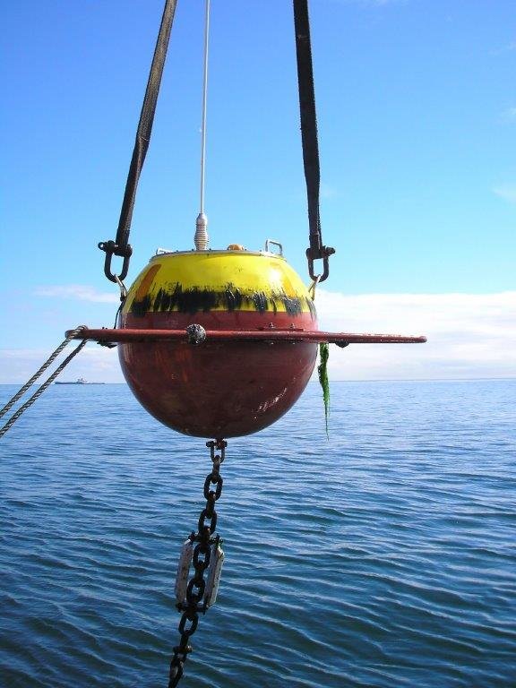
One of the buoys deployed during the Ossian survey